Windgap and Tullaghought TownslandsBallynalinagh Baunfree Baunreagh Birchwood Bregaun Corragaun Corragaun Curraghnadimpaun Cussan Garranhalloo Glencommaun Gortnaglogh Inchanaglogh Kilmacoliver Knickeen Knockglass Knockroe Lamoge Meallaghmore Pollrone Tullahought Butlerswood Coolehill Lower Coolehill Upper Farranaree Frankfort East Frankfort West Garranmachenry Garryrickin Garrythomas Killamery Kiltallaghan Kiltrassy Meallaghmore Lower Meallaghmore Upper Oldcastle Lower Oldcastle Upper Pollagh Roscon Rossaneny Seskin Windgap
|
Did your family live in Windgap area in 1659 ?
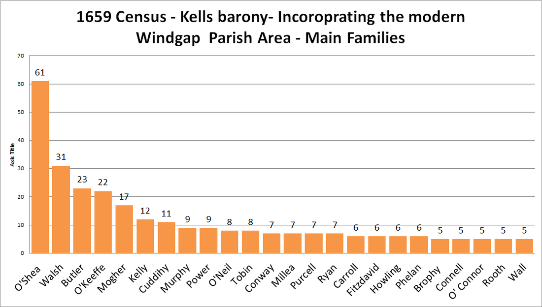
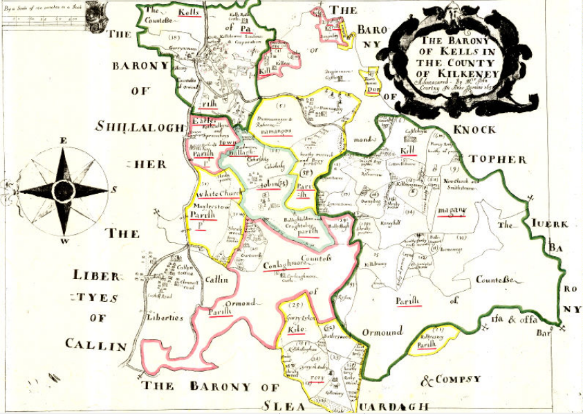
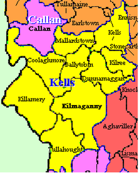
The Census of Ireland (1659), was also known as Petty's or Pender's Census. It provides townland census returns of the inhabitants of most of the country, It also gives the number of inhabitants and their racial classification, the returns supply the names of the principal occupiers, referred to as ‘Tituladoes’. Far more interesting is the fact that it also gives the surnames and counts of the principal Irish families, by barony. The local records are actually for the Barony of Kells, but keep in mind the population in 1659 was likely one tenth of the current population, with just over half a million estimated from this census. The barony of Kells incorporated the following civil parishes, Killamery, Tullahought, Kilmoganny, Dunamaaggin. Kilkree, Ballytobin, Mallardstown and Kells. I have converted the names into the 21st century form where possible (likely due to 1659 government enumerator errors and the fact that Irish was the dominant language in this area, and names had not often really been translated to English). It is amazing that the names from this area feature so strongly 354 years later. The O'Shea's and Walsh's unsurprisingly fill the top two positions. |


